
Thursday 15th April 2021
What a bad night. It was 27 degrees in Madeline’s bunk area when we put her to sleep. By 11pm the fan was off and a light cover on her as it was 24 degrees. By 130am it was 22 degrees so I put a beautifully knitted Pom Pom cover on her.
At around 2am Madeline was screaming to get her out. She found the Pom Pom cover on her and cracked the shits. After failed attempts to get her back to sleep, I carried her to our bed.
She said she didn’t want to sleep anymore. And despite being cold to the touch, chucked an absolute wobbly when we pulled the covers up to 1) cover her and 2) to cover ourselves. She wanted to sleep on top of the cover and wouldn’t have it any other way.
It was 18 degrees by 5am. She was about as cold as before, lucky she is sharing body heat. Still kicking the added covers off.
We woke up for the day at 640am, completely exhausted and sore due to the contorted sleeping positions.
Madeline was more than happy to cover up with the Pom Pom blanket once awake. I have no idea how we are going to survive the extremes as winter rolls in. We can’t dress her for 18 degrees, when we still need fans when heading to sleep.
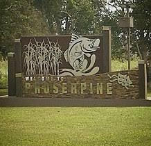
Proserpine
We left Pleystowe after packing up at around 940am.
The drive to Proserpine was uneventful except for a while heap of roadworks. We also couldn’t fill up water along the way, as the water station was too far from the road for our hose.
We pulled into the town of Proserpine at around 11am.
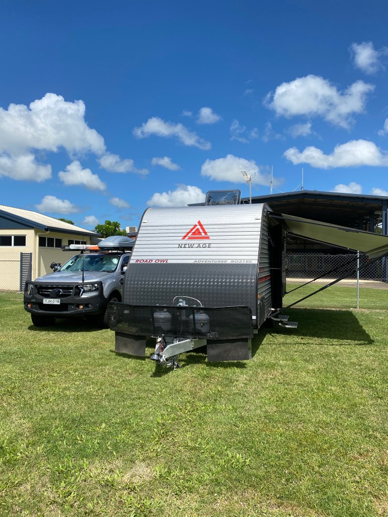
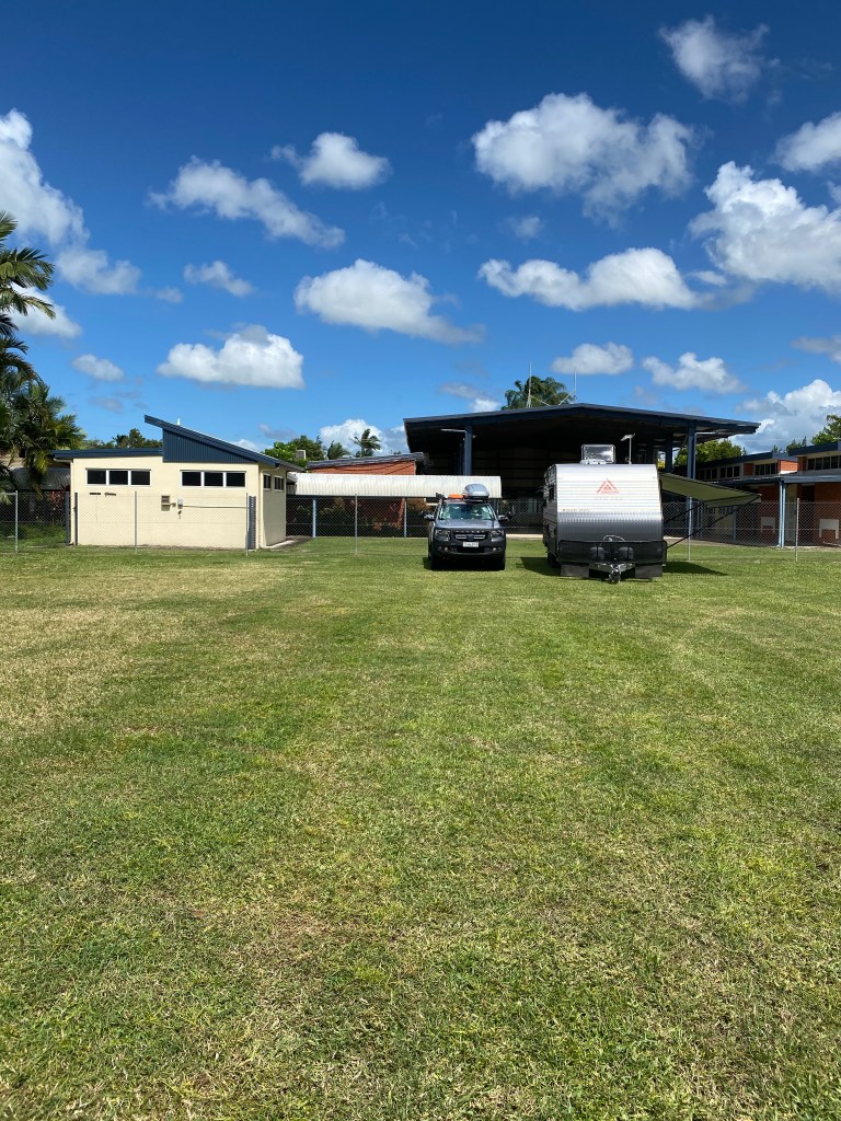
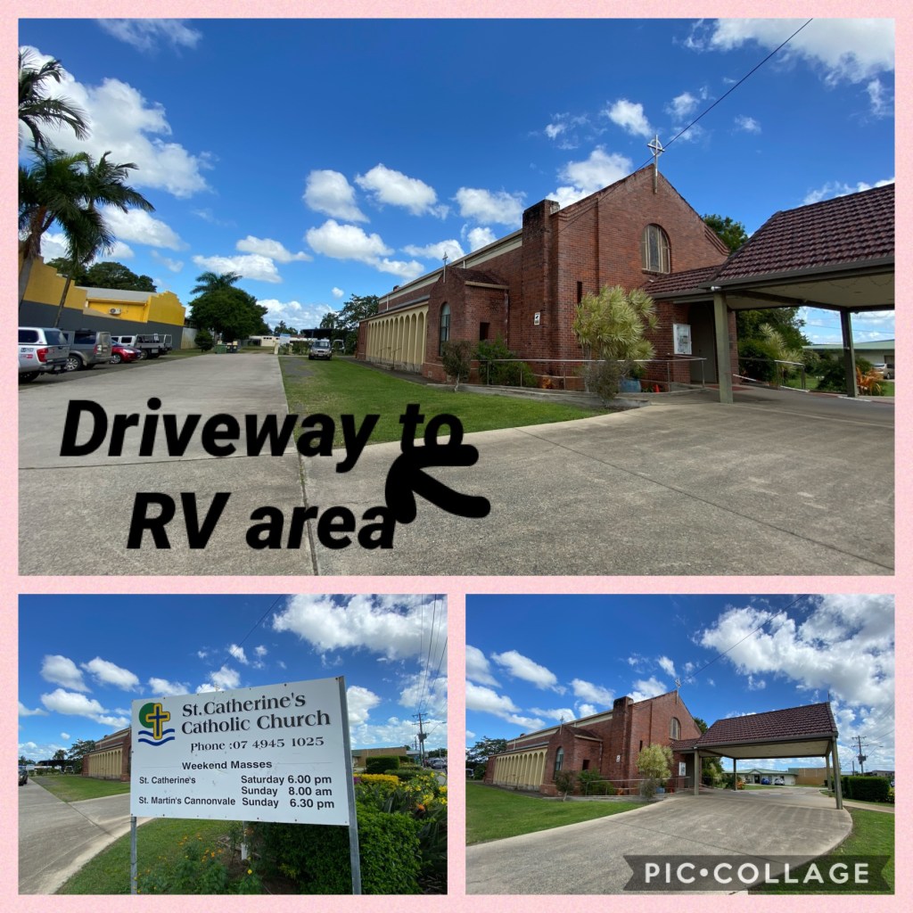
We are forever restful to council and St Catherine’s Catholic Church for giving us access to a free, grassy site for 48hrs.
Free camping if few and far between in towns nowadays. People either do it illegally and park in car parks or end up in a gravel pit on the side of a highway.
We give cudos to the towns who provide a safe, flat area for us to have a few days. As a thank you we spend money in the town.
After lunch we walked across the road to the playground. Completely fenced in, about 5 sheltered picnic tables, large established trees, soft floor matting around the grounds and lush green grass. Another big tick to council.
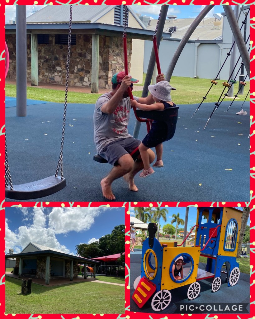
We had a cup of tea and some homemade pumpkin damper after the park.
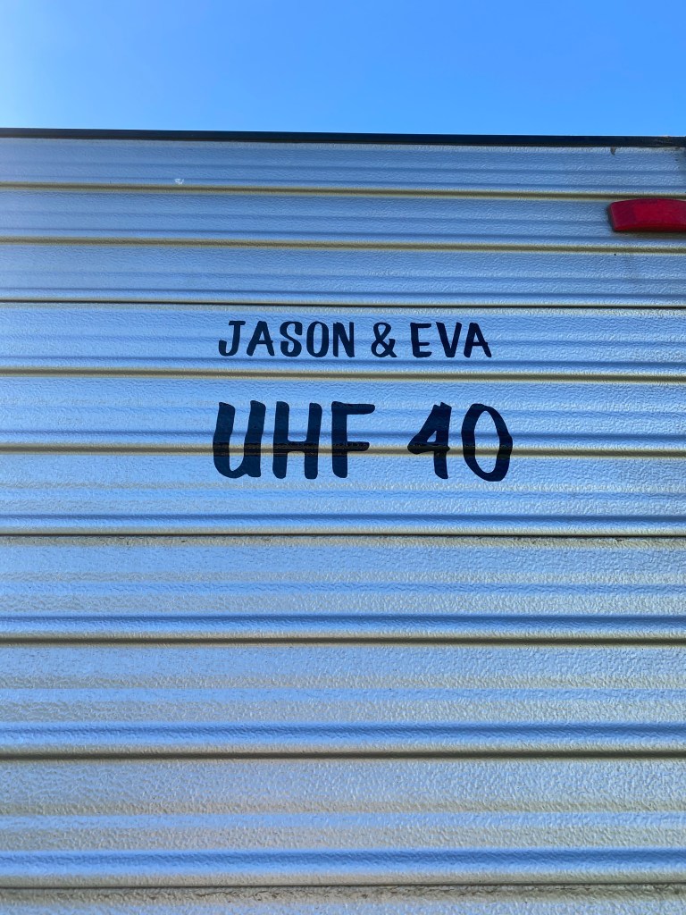
Jason put up our decal on the van. The UHF station number refers to the station we are tuned into on our travels. Having a sign on the caravan alerts truck drivers and other caravanning families to contact us while driving. They can use our call name also on the van.
This is used for; helping trucks overtake when we are too slow, to be alerted to wide loads, to be alerted to road hazards, to be alerted to upcoming road trains, to be alerted if there is an issue with our tow vehicle or caravan.
Proserpine history
Proserpine is a town and a locality in the Whitsunday Region, Queensland.
Geography
Proserpine is situated on the Bruce Highway and along the banks of the Proserpine River. It is surrounded by vast flat areas of land currently primarily used for sugarcane farming and urban expansion. Clarke Range is located to the west, Dryander National Park is to the north, and to the east is Conway National Park.
The Clarke Range to the west of the town contains the small, former gold mining town of Dittmer and provides a backdrop to the area.
History
The Gia people are the traditional Aboriginal Australians of the Proserpine area. Giya (also known as Kia) is a language of North Queensland.
George Elphinstone Dalrymple named the Proserpine River on an expedition in 1859. Proserpine derives from the legend of the Greek goddess of fertility Persephone (whose Latin name is Proserpine).
The first British colonists arrived in the early 1860s with Daniel Emmerson forming the Proserpine pastoral station.
The Crystal Brook Sugar Company was formed in 1882 and established a sugar industry in the region a year later. A sugar mill was built and the labouring on the plantation was performed by imported South Sea Islanders. In 1893 the plantation, which was located at Glen Isla close to the present Proserpine township, was closed and smaller sugar farms run by white owner-operators were established.
The township of Proserpine was created in the 1890s. The Postal Office opened in 1886. The town experienced high growth in the 1900s as the local sugar industry grew and exported raw sugar via the Proserpine Landing from here it was sent to refineries.
In 1944 the Australian Field Experimental Station was constructed at Gunyarra just south of the town. It was constructed to test and research the effectiveness of Mustard Gas in tropical conditions.
In the 1950s the Proserpine Airport was opened which increased the towns accessibility by air.
In 1986 construction commenced on the Peter Faust Dam 25 kilometres (16 mi) north-west of the town to be used for flood mitigation during the wet season and irrigation during the dry. The dam was completed in 1990 and was expected to take decades to fill but a passing cyclone helped boost levels close to maximum capacity. record amount of cane in 1996.
Crocodiles
So little did we know that all crocodile sightings in QLD should be reported. This lead to the discovery of an APP called QWildlife Crocwatch.
It allows us to see times and places of sightings in the locality we are staying or visiting.
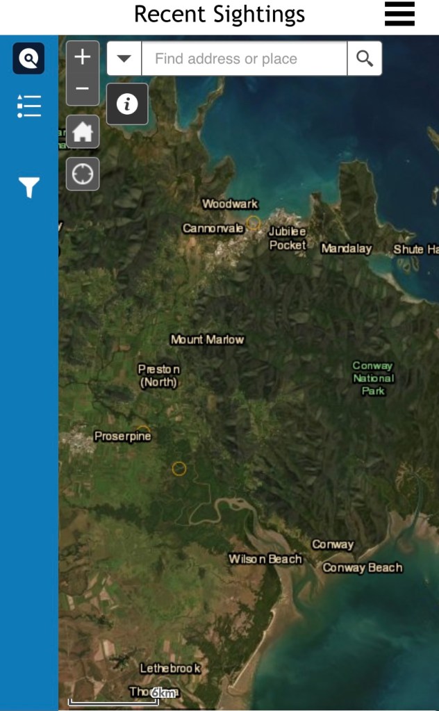
This is the area we are currently in. You can see 2 circles. One sighted on the 14th April on the bank of the Proserpine river. The other back on the 8th March near Cannonvale.
Crocodiles in certain zones are removed regardless of size and behaviour.
Tomorrow
We are off to Airlie Beach.
